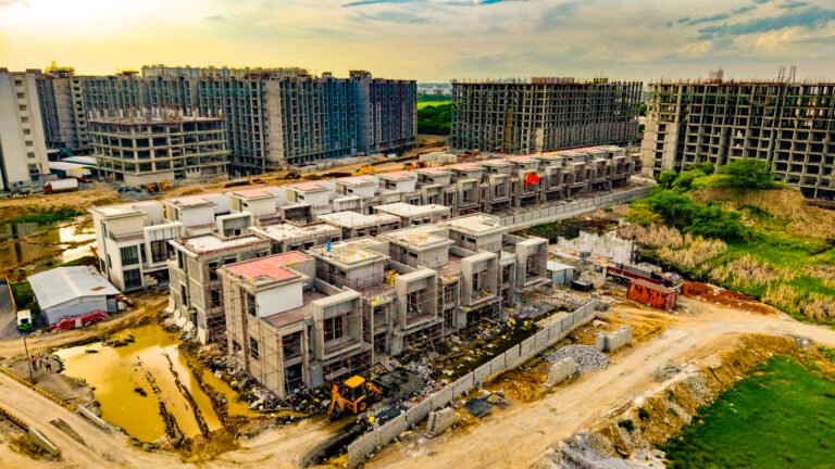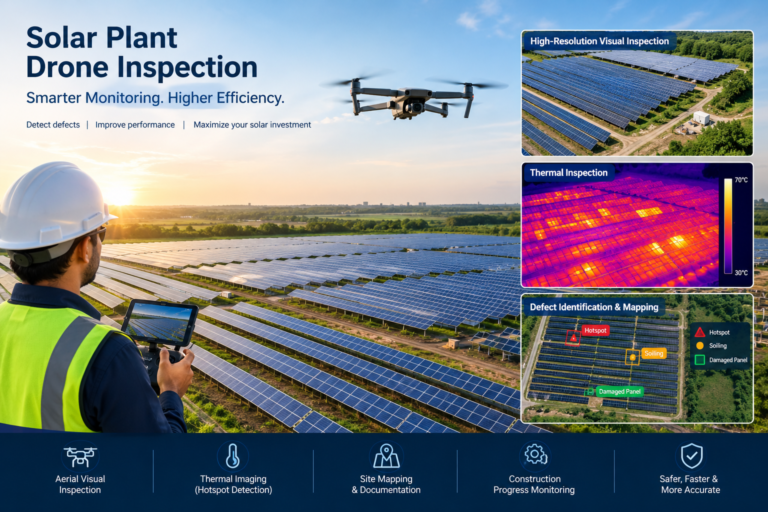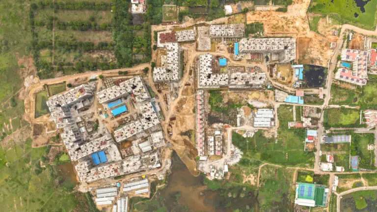
Site Construction Progress Monitoring Using Drones.Construction projects involve multiple teams, contractors, engineers, architects and stakeholders working simultaneously. As a project progresses from land preparation to structural work, every stage needs to be monitored, documented and compared against the planned schedule.
Traditional construction monitoring often depends on site visits, photographs, manual measurements and periodic reports. While these methods remain important, drone-based construction progress monitoring provides an additional aerial view that can help project teams understand what is happening across the entire site.
With regular drone flights, construction companies can create a visual record of the project, compare progress over time, generate aerial maps and 3D models, and share updated site information with stakeholders.
Modern construction drone workflows can produce outputs such as orthomosaics, 3D models, point clouds, DSM/DEM data and other mapping products.
Site Construction Progress Monitoring Using Drones
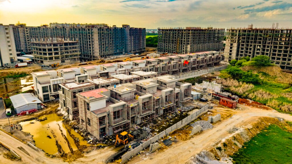
Construction progress monitoring using drones is the process of regularly capturing aerial photographs, videos and, where required, survey-grade mapping data of a construction site.
The data collected during each visit can be compared with previous site records to understand:
- What work has been completed
- Which areas are currently under construction
- Whether the project is progressing as planned
- Changes in the site layout
- Material and equipment movement
- Earthwork progress
- Structural development
- Road and infrastructure development
- Overall site conditions
Instead of looking at a construction project only from ground level, project managers can obtain a bird’s-eye view of the complete site.
DJI’s construction workflow describes drone-generated visual data as a way to monitor project progress and create 2D maps and 3D models that can be compared with historical data.
Why Use Drones for Construction Progress Monitoring?
Large construction sites can extend across several acres or even hundreds of acres. A ground-level inspection may provide detailed information about one area but may not provide an immediate understanding of the entire project.
A drone can capture a broader perspective in a relatively short field operation.
Key advantages include:
- Complete aerial overview
- Regular progress documentation
- Easier comparison between different dates
- Visual records for project meetings
- Improved communication between teams
- Identification of areas requiring attention
- Construction marketing content
- Mapping and 3D documentation
- Better remote visibility for stakeholders
Autodesk notes that regular photogrammetry updates can help project managers compare new imagery with earlier images, track completed work and identify areas requiring attention.
1. Create a Baseline Survey Before Construction
One of the most valuable drone flights can happen before construction begins.
A baseline aerial survey can document the original condition of the site.
This may include:
- Existing land condition
- Boundaries
- Roads
- Vegetation
- Existing structures
- Drainage
- Nearby developments
- Terrain
- Stockpiles
- Access roads
This baseline becomes the reference point for future progress monitoring.
For example:
Day 1 — Existing Site
↓
Month 1 — Site Preparation
↓
Month 3 — Foundation Work
↓
Month 6 — Structural Development
↓
Month 12 — Building Completion
The resulting timeline provides a visual history of the construction project.
2. Monitor Site Development Regularly
Drone flights can be scheduled weekly, fortnightly or monthly depending on the project’s requirements.
During each visit, the drone can capture a consistent set of images and videos.
The important part is consistency.
Whenever possible, maintain similar:
- Flight paths
- Camera angles
- Altitudes
- Capture areas
- Reference points
This makes it easier to compare images from different dates.
Instead of asking:
“How much progress have we made?”
the project team can visually compare:
Previous Survey vs Current Survey
and identify what has changed.
3. Track Earthwork and Land Development
Before buildings rise from the ground, major earthwork may take place.
Drone mapping can help document:
- Excavation
- Land grading
- Soil movement
- Road formation
- Drainage work
- Site leveling
- Embankments
- Stockpiles
- Foundation preparation
With suitable mapping workflows, drone imagery can also be processed into 3D models and elevation products.
DJI’s current construction mapping workflow describes outputs including 3D models, DSM, DEM, point clouds and orthomosaic imagery for construction progress analysis.
4. Monitor Building Construction
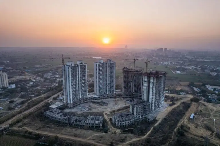
Once structural work begins, drones can provide a high-level overview of the development.
Aerial imagery can document:
Foundation Stage
Foundation areas and excavation work.
Structural Stage
Columns, slabs and structural elements.
Building Envelope
External walls, roofing and façade development.
Infrastructure Stage
Roads, landscaping, drainage and utilities.
Finishing Stage
External finishing, amenities and surrounding development.
This creates a visual record that can be particularly useful during monthly project reviews.
5. Compare Construction Progress Over Time
One of the biggest advantages of drone construction monitoring is the ability to compare different dates.
For example:
January
Only foundations visible.
March
Structural columns completed.
June
Multiple floors constructed.
September
External façade work underway.
December
Building nearing completion.
Aerial images can make these changes immediately visible.
Photogrammetry platforms can also support comparison of current site conditions with historical data and, in some workflows, design information.
6. Create Construction Progress Videos
Not every client needs a technical mapping report.
Sometimes the most useful deliverable is a professional construction progress video.
A monthly drone shoot can be edited into:
- Progress videos
- Investor updates
- Management presentations
- Social media videos
- Project launch videos
- Developer presentations
- Website content
- YouTube videos
For example:
Month 1 → Month 3 → Month 6 → Month 9 → Month 12
can be converted into a cinematic construction time-lapse.
This is particularly useful for builders who want to demonstrate visible project progress to customers.
7. Use Drone Data for Project Meetings
Construction projects involve many stakeholders.
A developer may need to communicate with:
- Architects
- Engineers
- Contractors
- Project managers
- Investors
- Consultants
- Clients
- Sales teams
A current aerial image can make these discussions easier.
Instead of explaining:
“The work in this portion of the site has progressed.”
the project manager can point directly to the relevant area on the latest aerial map.
Drone platforms can also allow teams to share aerial data remotely for collaboration and project review.
8. Monitor Multiple Areas of a Large Construction Site
Large sites often contain several activities happening simultaneously.
For example:
Zone A: Foundation work
Zone B: Structural work
Zone C: Road construction
Zone D: Material storage
Zone E: Landscaping
Zone F: Drainage
Aerial imagery provides a single view of the complete site.
This can help management understand how different work zones are progressing without relying exclusively on separate photographs from multiple teams.
9. Track Construction Materials and Stockpiles
Drone mapping can also be useful for monitoring material storage and earthwork.
Depending on the required accuracy and survey methodology, aerial mapping can support measurements of:
- Soil stockpiles
- Sand
- Aggregates
- Excavated material
- Fill material
- Other bulk materials
Specialized drone mapping workflows can generate data that supports quantity estimation and earthwork monitoring. DJI’s construction ecosystem includes drone-based applications for earthwork and stockpile volume measurements.
For contractual or high-precision quantity measurements, however, the appropriate surveying methodology, control points and professional verification should be used.
10. Create 2D Construction Site Maps
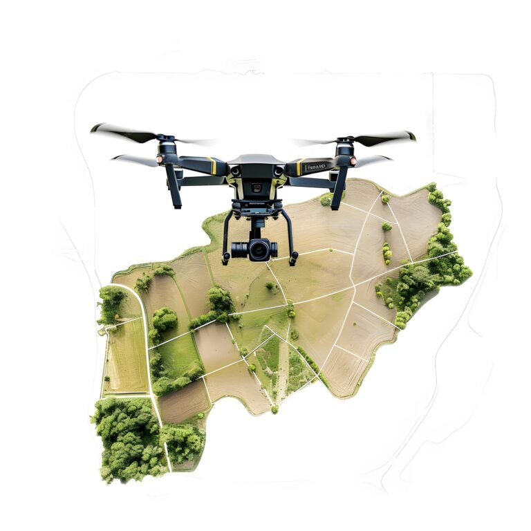
Drone photographs can be processed using photogrammetry software to create an orthomosaic map.
An orthomosaic combines many aerial photographs into a single geometrically corrected map.
This can provide a detailed aerial representation of the construction site.
Depending on the equipment and processing workflow, the output can support:
- Site planning
- Progress comparison
- Measurement
- Documentation
- Area calculations
- Construction coordination
Platforms such as PIX4Dcloud are specifically designed around a workflow of capture → process → analyze → share for drone mapping, progress monitoring and site documentation.
11. Create 3D Models of Construction Sites
Drone photogrammetry can also be used to create three-dimensional representations of construction sites.
A 3D model can help teams visualize:
- Buildings
- Terrain
- Excavation
- Roads
- Structures
- Stockpiles
- Site changes
This can provide a more informative representation than a conventional photograph.
For suitable projects, 3D data can also be incorporated into broader surveying, BIM and construction workflows.
12. Compare As-Built With Design Data
For projects using digital design or BIM workflows, drone-generated data can potentially be compared with design information.
This allows teams to investigate whether actual construction is progressing in accordance with the planned design.
Some drone construction platforms support workflows for comparing current site data with design drawings or BIM information.
This should be treated as a technical surveying workflow rather than simply a standard drone photography service.
Where dimensional accuracy matters, appropriate surveying equipment, ground control, RTK/PPK workflows and professional validation may be required.
13. Improve Construction Safety Awareness
Construction sites contain many areas where access can be difficult or potentially hazardous.
Drones can capture visual information from locations that may be inconvenient or unsafe for routine photography.
Autodesk highlights drone-based photogrammetry as a way to capture information from areas where physical access can present safety challenges.
However, a drone should not be treated as a replacement for mandatory site safety inspections or professional safety personnel.
It is an additional visual-data collection tool.
14. Construction Progress Monitoring for Real Estate Developers
Drone monitoring is especially valuable for property developers.
A developer can use periodic drone footage to create a complete visual history of:
Land → Development → Construction → Amenities → Completion
This content can then be used for both internal monitoring and marketing.
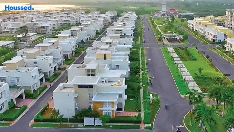
For example, a builder developing a large residential community could document:
- Entrance road
- Individual blocks
- Villas
- Clubhouse
- Swimming pool
- Landscaping
- Internal roads
- Children’s play areas
- Street lighting
- Overall development
This can later become a powerful project presentation.
15. Use Construction Drone Videos for Customer Communication
Property buyers often want to know:
“Is the project actually progressing?”
Regular progress videos can help developers communicate construction updates.
A short monthly video could show:
“Construction Progress — October 2026”
followed by aerial footage of the latest development.
This can be shared through:
- Website
- YouTube
- Customer portals
It transforms construction monitoring data into useful customer communication.
16. Create a Construction Time-Lapse
One of the most visually powerful applications is a long-term aerial time-lapse.
Imagine capturing the same project every month from a consistent aerial perspective.
The final video can show:
Month 1 → Month 2 → Month 3 → Month 4 → Month 5 → Month 6 → Completion
The transformation of an empty site into a completed development can become valuable marketing content for the developer.
It can also become part of the project’s final documentation.
Construction Drone Monitoring Workflow
A professional workflow can be structured as follows:
Step 1 — Understand the Project
Identify the site size, construction stage and monitoring objectives.
Step 2 — Plan the Flight
Define the flight area, altitude, routes, capture points and required imagery.
Step 3 — Capture Aerial Data
Capture high-resolution photographs, video or mapping imagery.
Step 4 — Process the Data
Depending on the project, process the images into:
- Orthomosaic
- 3D model
- Point cloud
- DSM/DEM
- Progress images
- Videos
Step 5 — Compare With Previous Data
Compare current imagery with previous surveys.
Step 6 — Identify Progress
Highlight completed work and areas requiring attention.
Step 7 — Prepare the Report
Deliver photographs, maps, videos or other agreed outputs.
Step 8 — Maintain a Historical Record
Store each survey so that the project can be reviewed over time.
How Often Should Construction Sites Be Monitored?
There is no single frequency suitable for every project.
The schedule depends on:
- Project size
- Construction speed
- Number of work zones
- Client requirements
- Reporting requirements
- Project duration
- Budget
- Required level of detail
A common approach is:
Weekly: Fast-moving or critical construction activities
Fortnightly: Active construction projects requiring regular monitoring
Monthly: General project progress documentation
Milestone-based: Foundation, structural completion, façade, amenities and final completion
For large or complex projects, automated or recurring drone data collection can also be considered where the applicable operational and regulatory requirements are met. DJI describes automated recurring construction-site monitoring as one possible workflow using its Dock and FlightHub ecosystem.
Drone Construction Monitoring vs Traditional Site Photography
| Traditional Site Photography | Drone Construction Monitoring |
|---|---|
| Ground-level perspective | Aerial perspective |
| Limited field of view | Large-area overview |
| Multiple locations needed | Large site can be captured efficiently |
| Difficult to compare entire site | Easier visual comparison |
| Mainly photographs | Photos, video and mapping outputs |
| Manual documentation | Repeatable capture workflows |
| Limited spatial context | Strong site-level context |
| Can require access to difficult areas | Aerial view can reduce some access requirements |
The two approaches should not necessarily compete.
Ground photography + drone photography + surveying + project documentation can provide a more complete monitoring system.
What Deliverables Can a Construction Drone Service Provide?
Depending on the project requirements, a construction drone monitoring service can include:
Aerial Photography
High-resolution photographs of the complete site.
Aerial Video
Cinematic or documentation-focused construction videos.
Progress Comparison
Before-and-after images showing project development.
Orthomosaic Mapping
Georeferenced aerial site maps where appropriate.
3D Models
Photogrammetry-based 3D site representations.
Point Clouds
Three-dimensional spatial datasets for suitable surveying workflows.
Construction Time-Lapse
Long-term visual documentation of project development.
Progress Reports
Aerial images and observations organized by project stage.
The exact deliverables should be agreed upon before the flight because a cinematic drone shoot, progress-monitoring survey and survey-grade mapping project are different services.
Drone Construction Monitoring in Chennai and India
Construction projects across Chennai and Tamil Nadu can benefit from aerial progress documentation, particularly for:
- Residential apartment projects
- Villa developments
- DTCP layouts
- Commercial buildings
- Industrial projects
- Warehouses
- Roads
- Infrastructure projects
- Solar installations
- Large land developments
- Institutional campuses
For large projects, recurring drone surveys can create a valuable visual record from the beginning of construction through completion.
Drone Regulations for Construction Sites in India
Drone operations at construction sites must follow the applicable Indian aviation regulations and current DGCA requirements.
The DGCA’s current guidance states that applicable drone operators should use DGCA type-certified and registered drones, hold the applicable Remote Pilot Certificate where required, check airspace before flights, maintain visual line of sight and obtain the necessary permissions for restricted airspace.
The DGCA website currently provides drone regulatory information and eGCA services, and its published regulatory information includes the Drone Rules, 2021.
Construction sites can also contain workers, cranes, power lines, tall structures and other obstacles. Therefore, every flight should include appropriate pre-flight planning, site coordination and safety assessment.
Drone permission requirements can vary according to the location and operation, so the applicable airspace and regulatory requirements should always be checked before the flight.
Why Construction Companies Should Use Drone Progress Monitoring
Construction progress monitoring using drones provides a practical way to combine visual documentation, mapping and project communication.
The biggest advantages are:
✔ Complete aerial site visibility
✔ Regular construction documentation
✔ Easy visual comparison
✔ Progress videos and time-lapse
✔ 2D mapping
✔ 3D modelling
✔ Earthwork documentation
✔ Stockpile monitoring
✔ Remote project visibility
✔ Better communication with stakeholders
✔ Marketing content for completed stages
The value becomes even greater when the same data is collected consistently throughout the project.
Final Thoughts
A construction project changes every week.
A single photograph taken today may become a valuable reference several months later when compared with new aerial data.
With a properly planned drone construction progress monitoring program, developers, contractors and project managers can build a visual history of their project from the initial site condition to final completion.
The complete workflow can be summarized as:
PLAN → FLY → CAPTURE → PROCESS → COMPARE → REPORT → MONITOR
For simple projects, this may mean regular high-resolution aerial photography and progress videos.
For larger technical projects, it can extend to:
Drone Mapping + Orthomosaic + 3D Model + Point Cloud + Progress Comparison + Survey Data
The important point is to select the right level of drone service for the project’s actual requirements.
For more technical construction applications, DJI’s current construction solutions describe workflows involving 2D maps, 3D models, orthomosaics, DSM/DEM and point clouds, while PIX4D provides cloud-based workflows for construction progress monitoring and site documentation.
How MyDigitalBrand Can Help
MyDigitalBrand can provide professional drone-based construction site documentation and progress monitoring for builders, developers, contractors and infrastructure projects.
The service can be planned around your project requirements, including:
- Construction progress drone photography
- Construction progress videos
- Monthly aerial documentation
- Before-and-after progress comparison
- Construction time-lapse
- Real estate development documentation
- Site overview videos
- Drone mapping workflows where required
- Project marketing videos
You can also explore Drone Shoot in Chennai for professional aerial photography and videography.
For broader information about construction monitoring, see Construction Drone Progress Monitoring in India.