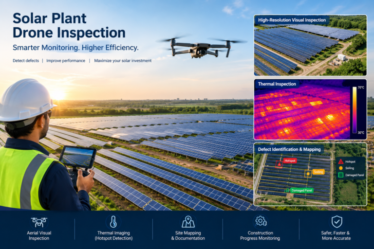
Drone Shoot for Solar Plant . Solar power plants cover large areas with thousands of photovoltaic panels. Inspecting every panel manually can be time-consuming, especially when the plant is spread across several acres.
This is where drone-based solar plant inspection can provide a faster way to collect detailed visual and, when suitable thermal equipment is used, infrared data across large PV installations.
Aerial inspection is already recognized as an important PV inspection method. IEA PVPS notes that drone-mounted imaging can help identify problems across solar installations, while aerial infrared inspections can detect thermal signatures associated with several PV failure modes.
What Is Solar Plant Drone Inspection?
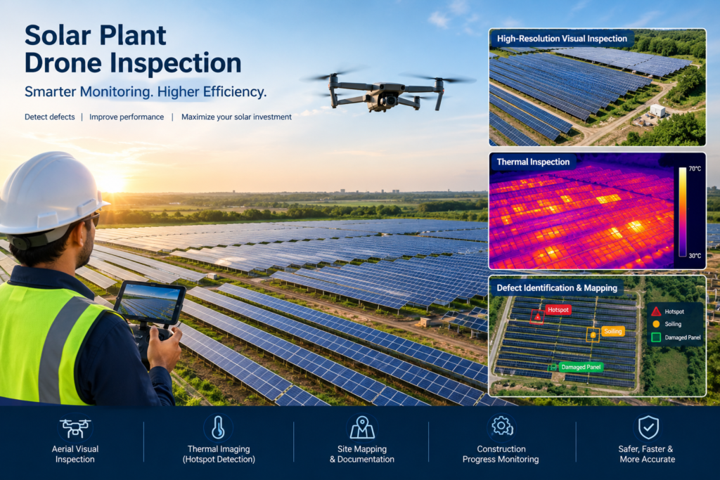
Solar plant drone inspection involves flying a drone over a solar installation to capture high-resolution aerial imagery of:
- Solar panels
- Module rows
- Mounting structures
- Inverters and equipment areas
- Electrical infrastructure
- Internal roads
- Vegetation
- Drainage areas
- Fencing and site boundaries
- Construction and maintenance areas
Depending on the inspection requirement, the drone may use a high-resolution RGB camera, thermal/infrared camera, or other specialized sensors.
The resulting imagery can then be reviewed, mapped and organized into an inspection report.
Why Use a Drone for Solar Panel Inspection?
Large solar plants can contain thousands or even hundreds of thousands of modules.
Walking through every row can take significant time and may expose inspection teams to:
- Extreme heat
- Uneven terrain
- Electrical hazards
- Difficult-to-access areas
- Long distances between panel blocks
A drone can cover large areas from the air while maintaining a consistent inspection pattern.
IEA PVPS reports that aerial IR inspection can help identify problems such as hotspots, electrical mismatches, bypass-diode and junction-box issues, broken interconnections and localized soiling, although findings should be appropriately validated and interpreted.
1. High-Resolution Visual Inspection
The simplest drone inspection uses a high-resolution RGB camera.
This can help document visible conditions such as:
- Broken or damaged modules
- Cracked glass
- Discoloration
- Heavy soiling
- Vegetation growth
- Structural issues
- Loose or displaced components
- Damaged mounting structures
- Site access conditions
High-resolution aerial photographs also provide useful documentation for maintenance teams.
Instead of relying only on photographs taken from the ground, the operator can capture a broader view of the solar array and then zoom into individual areas during post-processing.
2. Thermal Drone Inspection of Solar Panels
Thermal imaging is one of the most valuable applications of drone technology for solar plant inspection.
A suitable thermal camera can identify abnormal temperature patterns across PV modules.
These thermal signatures may indicate potential problems such as:
- Hotspots
- Cell or module abnormalities
- Electrical mismatch
- Bypass diode issues
- Junction-box problems
- Damaged modules
- Some string-level abnormalities
IEA PVPS describes aerial infrared imaging as a useful non-destructive method for identifying multiple PV failure modes and emphasizes that inspection quality depends heavily on sensor capability and appropriate measurement conditions.
However, thermal imagery should not be treated as an automatic diagnosis. A thermal anomaly needs appropriate technical interpretation and, where necessary, confirmation using electrical measurements or ground inspection. IEA PVPS specifically notes the importance of cross-validation to reduce false positives and support root-cause analysis.
3. Detecting Solar Panel Hotspots
Hotspots are localized areas of abnormal heating on PV modules.
They can be associated with different electrical or physical conditions and may result in reduced performance or, depending on the underlying problem, increased equipment risk.
A thermal drone survey can quickly identify areas that deserve further investigation.
For a large solar farm, this can be significantly more practical than manually inspecting every module individually.
However, inspection conditions matter.
IEA PVPS best-practice material highlights factors such as irradiance, camera resolution, flight altitude and thermal sensitivity when performing aerial PV inspections.
4. Identify Soiling and Shading Problems
Solar panel performance can be affected by:
- Dust
- Bird droppings
- Leaves
- Mud
- Vegetation
- Nearby objects creating shadows
Aerial visual and thermal imagery can help maintenance teams identify areas where soiling or shading may require attention.
This becomes particularly useful for large solar plants where cleaning resources need to be prioritized.
IEA PVPS has highlighted localized soiling and vegetation-related shading as factors that can contribute to electrical mismatches and hotspots in PV systems.
5. Inspect Large Solar Farms Faster
One of the biggest advantages of drone inspection is coverage.
Instead of sending multiple technicians across a large site to visually inspect every section, a planned drone mission can systematically capture the solar array from the air.
For example:
Solar Plant → Flight Planning → Aerial Data Capture → Image Processing → Defect Identification → Inspection Report
The exact survey time depends on plant size, drone, sensor, weather, flight parameters and the required inspection resolution.
IEA PVPS has reported that a 4 MWp plant could require approximately 5–10 hours for an IR inspection under ideal conditions, illustrating that inspection duration varies significantly with the plant and mission setup.
6. Create an Aerial Record of the Solar Plant
Drone photography is useful not only for finding defects.
It can also create a visual record of the entire installation.
A solar operator can maintain periodic aerial documentation showing:
- Panel blocks
- Internal roads
- Equipment locations
- Vegetation conditions
- Boundary conditions
- Construction changes
- Maintenance areas
- Expansion areas
This creates a useful visual reference for future inspections.
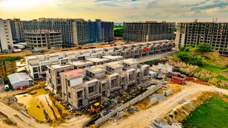
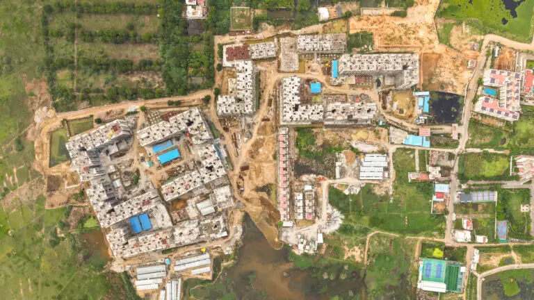
7. Solar Plant Construction Progress Monitoring
Drones can also be used before the plant becomes operational.
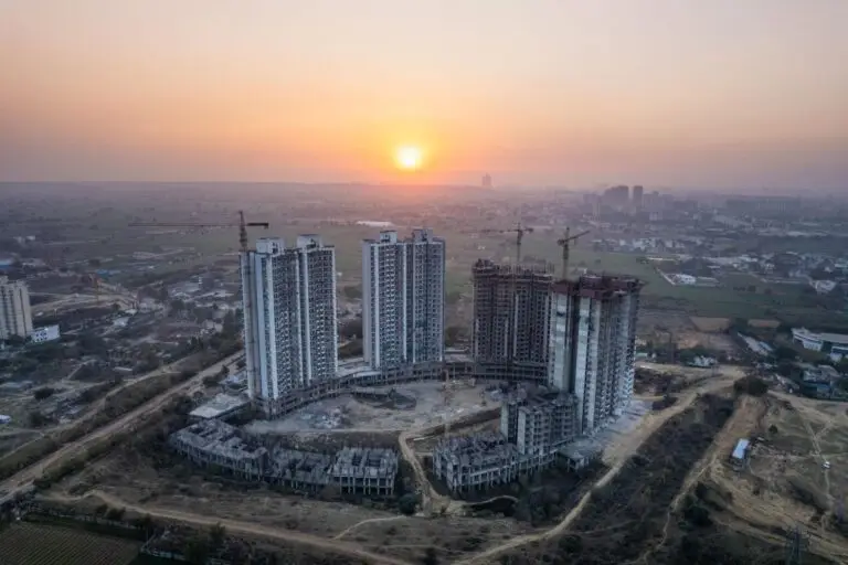
During solar plant construction, aerial photography can document:
Land Preparation
Monitor site preparation and grading.
Mounting Structure Installation
Document installation progress across different blocks.
Solar Module Installation
Track the number and location of installed module sections.
Electrical Infrastructure
Document installation of equipment and associated infrastructure.
Final Installation
Create an aerial record of the completed solar plant.
Regular drone flights can therefore create a visual construction timeline from site preparation to commissioning.
For large projects, drone mapping can also provide useful orthomosaic and 3D survey outputs when appropriate equipment, control and processing workflows are used.
8. Drone Inspection Can Reduce Unnecessary Site Visits
When aerial data identifies a specific area requiring attention, maintenance teams can prioritize that location instead of inspecting the entire site blindly.
For example:
Drone inspection identifies abnormal module → Technical team verifies module → Repair/replacement planned
This targeted approach can help maintenance teams focus their resources.
Digital inspection and remote monitoring are increasingly important in PV operations because large installations need efficient ways to maintain performance while controlling O&M costs.
9. Combine Drone Data With Solar Plant Performance Data
Drone inspection becomes even more useful when aerial findings are compared with other plant information.
For example:
Drone Thermal Data + RGB Images + Inverter Data + String Data + Ground Inspection
If a particular block is showing lower electrical performance and the drone survey identifies abnormal thermal patterns in the same area, the maintenance team has additional information for investigation.
This is why drone inspection should ideally be considered part of a broader solar plant O&M workflow, rather than a replacement for all electrical testing.
10. Generate an Inspection Report
A professional drone inspection should produce more than a collection of photographs.
Depending on the project scope, the final deliverables can include:
- Aerial photographs
- Thermal images
- Annotated defect images
- Defect location references
- Solar array overview
- Inspection map
- Orthomosaic
- 3D site model, where applicable
- Defect classification
- Visual comparison
- Recommended areas for further inspection
The exact deliverables should be agreed with the EPC, plant owner or O&M team before the survey.
RGB Drone Inspection vs Thermal Drone Inspection
It is important to understand the difference.
| Inspection Type | Main Purpose |
|---|---|
| RGB Drone Camera | Visual documentation and visible defects |
| Thermal Drone Camera | Identify abnormal thermal patterns |
| Mapping Drone | Orthomosaic, measurement and site mapping |
| 3D Survey | Terrain, structures and spatial documentation |
| Combined Inspection | Visual + thermal + mapping analysis |
A standard camera drone can provide valuable visual documentation, but thermal inspection requires a suitable radiometric or thermal imaging system and an appropriate inspection methodology.
Therefore, a solar plant should not be promised a thermal fault-detection service unless the required thermal equipment and analysis workflow are actually available.
When Should a Solar Plant Be Inspected?
Inspection frequency depends on:
- Plant size
- Environmental conditions
- Plant age
- O&M strategy
- Historical faults
- Performance issues
- Warranty requirements
- Site conditions
Some operators may schedule periodic aerial inspections, while others may initiate an inspection after noticing unusual performance.
A useful approach is to create a baseline inspection and then compare subsequent inspections.
Example
Inspection 1 → Baseline
↓
Inspection 2 → Compare
↓
Inspection 3 → Identify changes
↓
Inspection 4 → Track recurring issues
This creates a long-term visual history of the solar installation.
Best Conditions for Thermal Solar Drone Inspection
Thermal inspection is not simply a matter of flying a drone over the panels.
Environmental and operational conditions influence the quality of thermal data.
IEA PVPS guidance highlights the importance of factors including adequate irradiance, appropriate flight planning, sensor resolution and thermal sensitivity. One IEA-PVPS report recommends stable illumination of at least 600 W/m² in the plane of the PV module for certain aerial IR inspection conditions and references IEC TS 62446-3:2017 in its best-practice discussion.
Therefore, professional inspection planning should consider:
- Solar irradiance
- Wind
- Cloud conditions
- Ambient temperature
- Panel operating condition
- Camera specifications
- Flight altitude
- Ground sampling distance
- Camera angle
- Required inspection resolution
Drone Inspection for Rooftop Solar Plants
Drone inspection is not limited to utility-scale solar farms.
It can also be useful for:
- Factory rooftop solar
- Warehouse rooftop systems
- Commercial buildings
- Industrial facilities
- Educational institutions
- Large residential communities
- Solar carports
Rooftop inspections can be particularly useful where panels are spread across large or difficult-to-access roof areas.
However, safety planning becomes even more important around people, buildings, electrical infrastructure and restricted airspace.
Drone Inspection for Solar EPC Companies
Solar EPC companies can use drone imagery at multiple stages of a project.
Before Installation
Document the existing site.
During Installation
Track project progress.
After Installation
Create final project documentation.
During O&M
Perform periodic visual or thermal inspections.
Before Maintenance
Identify areas requiring closer investigation.
This allows drone services to become part of the complete solar project lifecycle rather than being used only for promotional photography.
Safety and Drone Regulations in India
Solar plants can be located near airports, industrial facilities, highways, power infrastructure or other restricted areas.
Drone operations must therefore be planned according to applicable Indian aviation regulations and the current airspace restrictions.
DGCA currently provides drone-related services through eGCA, and its official guidance emphasizes checking airspace, operating the applicable registered/type-certified UAS, holding the required Remote Pilot Certificate where applicable, maintaining visual line of sight and obtaining permissions where required.
DGCA also migrated drone-related regulatory services from the Digital Sky platform to eGCA beginning in July 2025.
Before every commercial solar inspection, the operator should verify the current applicable requirements, airspace status, permissions and site-specific safety conditions.
Why Solar Companies Should Consider Drone Inspection
A solar plant is a long-term energy asset.
Small problems that go unnoticed can potentially develop into larger maintenance or performance issues.
Drone inspection provides a practical way to collect detailed aerial information without physically walking every panel row.
The major advantages include:
✔ Faster visual coverage
✔ Access to difficult areas
✔ High-resolution aerial documentation
✔ Thermal inspection when suitable thermal equipment is used
✔ Early identification of areas requiring further investigation
✔ Construction progress documentation
✔ Periodic condition monitoring
✔ Better maintenance planning
✔ Digital inspection records
How MyDigitalBrand Can Support Solar Plant Drone Shoots
A professional drone shoot for a solar project can be planned according to the purpose of the inspection.
For example:
Solar Plant Visual Documentation
High-resolution aerial photographs and videos of the complete solar installation.
Construction Progress Monitoring
Periodic aerial documentation of solar installation progress.
Solar Panel Inspection
Detailed aerial imagery to identify visible panel and site conditions.
Thermal Inspection
Where suitable thermal equipment and technical analysis are included in the project scope, aerial infrared inspection can help identify thermal anomalies requiring further investigation.
Solar Project Marketing
Cinematic drone videos for EPC companies, developers and renewable-energy companies to showcase completed projects.
The same solar site can therefore generate both technical inspection data and professional marketing content, provided the flight and deliverables are planned accordingly.
Final Thoughts
Drone technology is changing how large solar installations can be documented and inspected.
Instead of relying entirely on manual inspection, solar operators can combine:
Drone Photography + Thermal Imaging + Mapping + Ground Verification + Electrical Data
to build a more comprehensive picture of plant condition.
The most important point is that a drone does not replace an experienced solar O&M engineer or electrical inspection. It is a data-collection and inspection-support tool that can help identify areas requiring closer technical attention.
For large PV installations, properly planned aerial inspection can make it easier to document the site, identify potential anomalies and prioritize maintenance investigations.
For technical guidance on aerial PV inspection and thermal imaging, the IEA PVPS guidance on PV plant inspection is a useful reference.
For Indian drone regulatory information, refer to the official DGCA and its eGCA services.
Related MyDigitalBrand Services
You can also explore Drone Shoot in Chennai for commercial aerial photography and videography, and Construction Drone Progress Monitoring for drone-based construction documentation and progress monitoring.